
Sunday, September 21, 2014
The weather is still miserable in Kapuskasing, and I have three things on my mind. First, this a long leg, the longest of the trip: four hours, give or take, to Winnipeg. Normally, that would not be a problem, but I am breaking in two new cylinders and must run at 70% power and rich of peak EGT. That means 15 gallons per hour, and the Bonanza holds 74. So today she's a five-hour airplane. Second, I would like enough of a ceiling so I can get the gear up before going IMC, and I don't want ice. But third, I can't go until I solve the problem that appeared on my arrival Friday afternoon: as I was starting the approach, suddenly the static in my headset was so loud I couldn't hear the radio. I could hear responses to my transmissions but couldn't make them out. It wasn't a factor at the uncontrolled field and I had been cleared for the approach so I ignored it and concentrated on landing.
I waste time tracking it down with my hand-held VHF, which receives a lot of noise when I turn on the master switch. (Well, not really wasted time, because it is in failure that you learn so much). Finally I realize that yes, it is as I thought last night when I was walking to supper: it is my own finger trouble. On the audio panel I had left NAV 1 on, and when I lost the Timmins VOR on descent there was just noise. It was more of a gotcha because my NAV 2 radio has a volume control which I use, leaving NAV 2 on. Now my COM checklist will include NAV 1 off.
There are hopeful bits of sun poking through as I start up, although the rain starts again at the same time, a powerful soaking mist. I turn on the windshield defrost. Birds are a problem, too. It is Sunday, so the airport guys shooting shotgun blanks from their truck are not on duty. I sashay down the runway like a taildragger with my lights on, trying to scare them off. I am doing my checks as well, because I want to line up and go before they come back.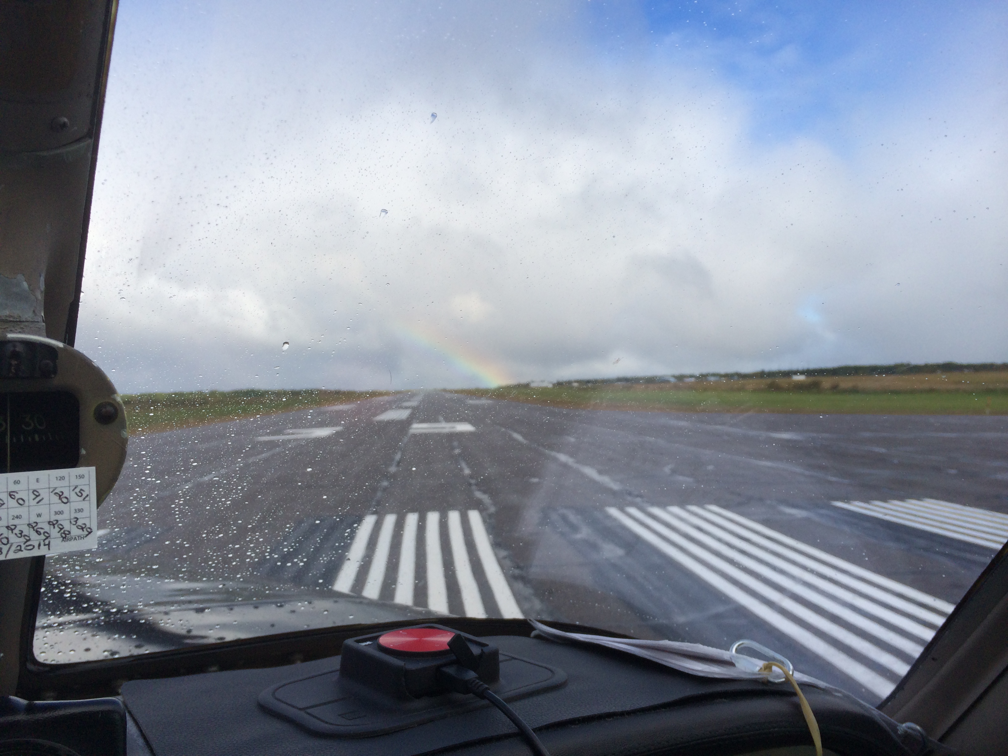
There is sun breaking through and there is a rainbow as I line up. A good omen.
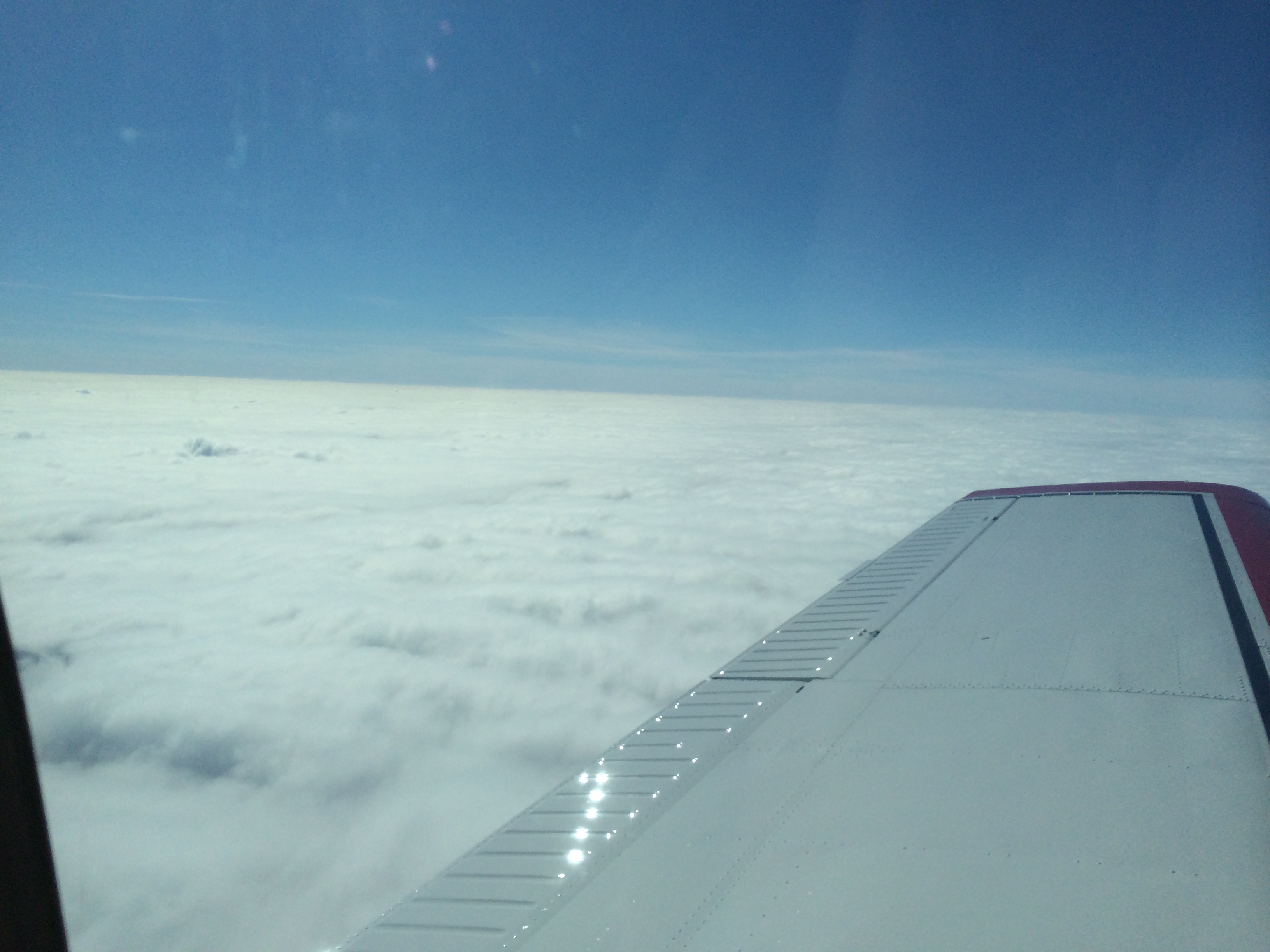
Gear up, and I'm into the clag, as the pilots say. Wet and bumpy despite the breaks of sun. Solid IMC until I get on top, between five and six thousand, just like the GFA said. And no icing, either – also as the GFA promised. There is warm air creeping in over this miserable wet stuff. The OAT on the climb went from 8° down to 0 and back up to 4°.
Now I settle down to the routine of cruise. Right tank when the big hand is on the right, and vice versa. Position reports. (A have to do a couple, because at 8000 I'm off ATC's radar for several hundred-mile sections of the track.) And then the luxuries: lunch – an apple, trail mix, and water. It tastes good. Best of all is the GoPilot my son and daughter in law got for me. I'm not young, and on a four-hour leg I need it. I'm learning how to use it without doing an inadvertent barrel-roll.
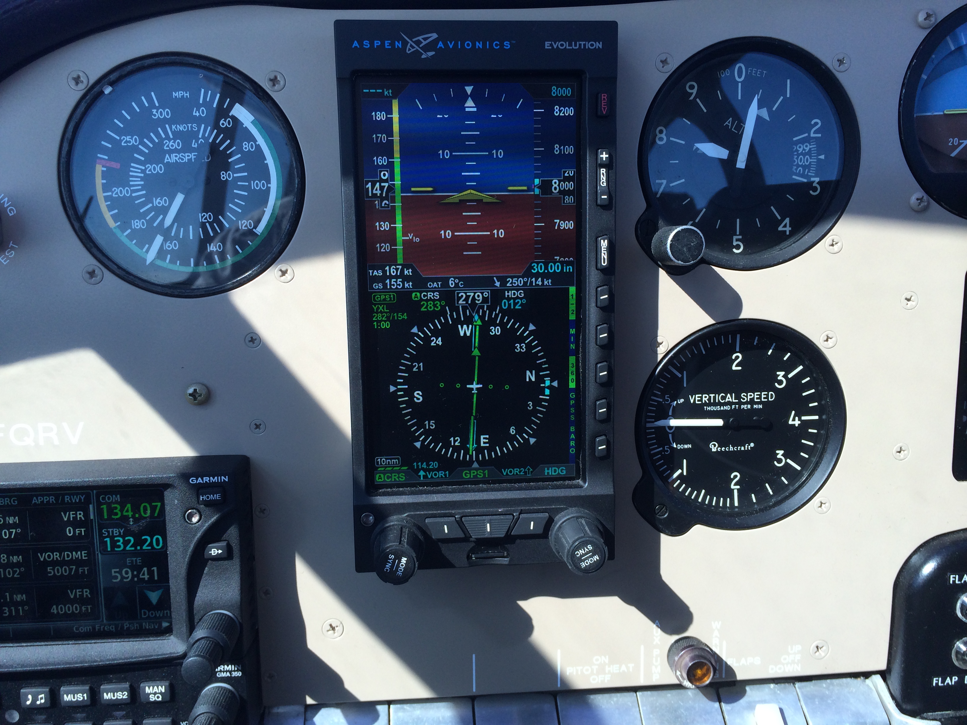
Still over a solid undercast. I have my Garmin GTN 650 on Nearest Airports, and I get the weather for those that report and learn runways, frequencies, and approaches just in case. Then I'm over Lake Nipigon.
 Almost exactly at the western shore the cloud below breaks up.
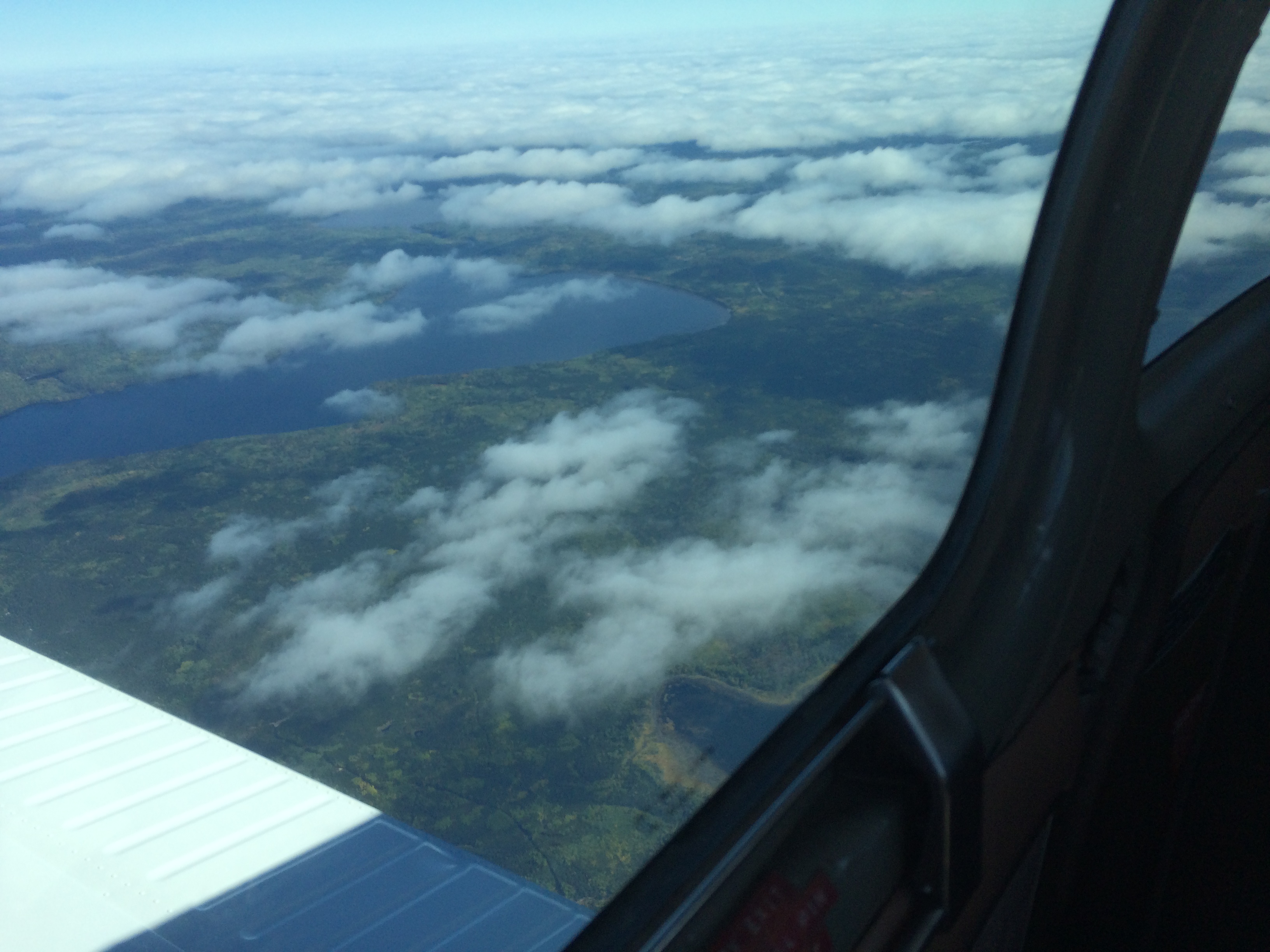
Yes, this is Canada, North of Superior. Minnesota may have 100,000 lakes – here there must be a million.
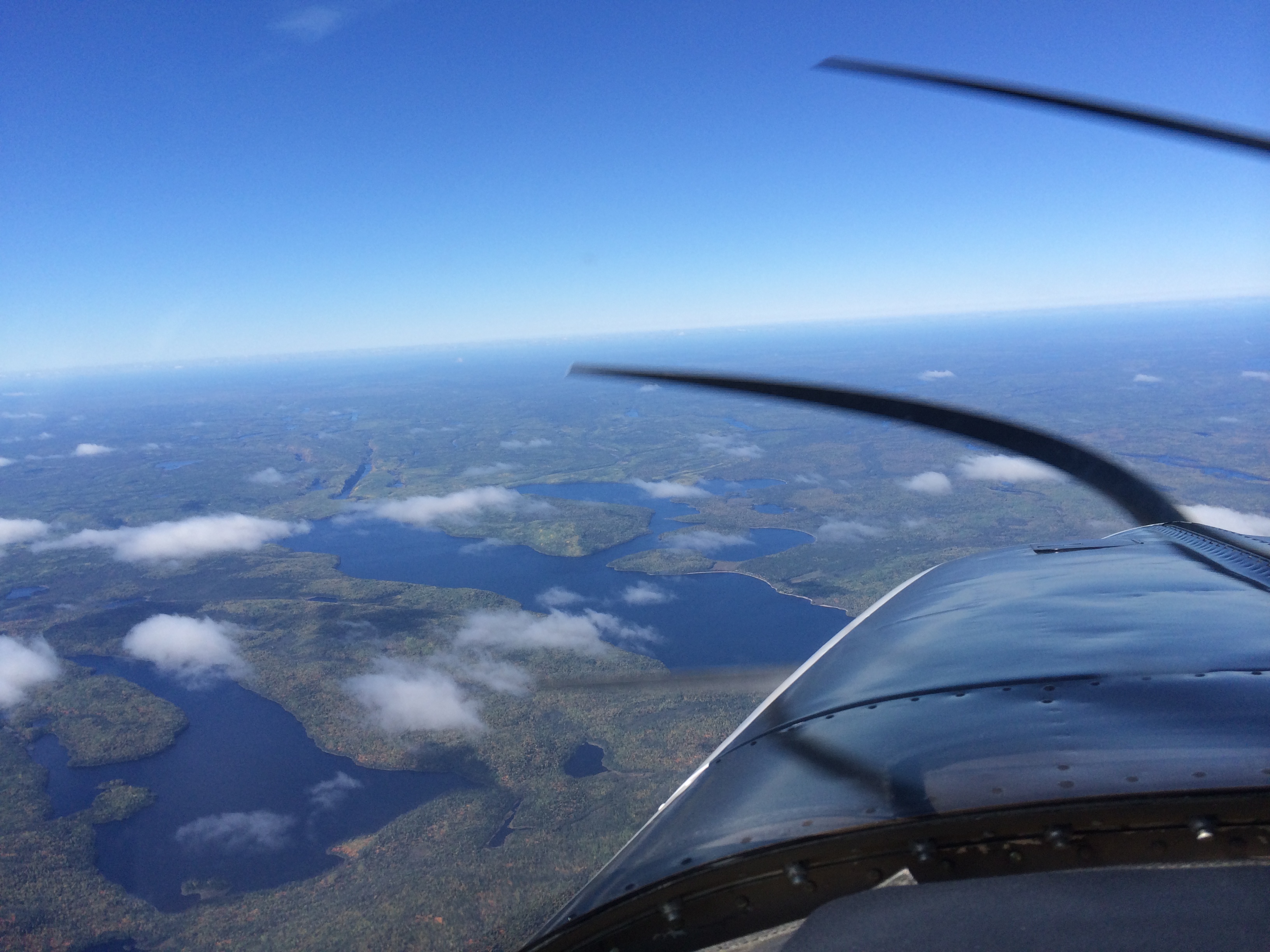
CYXL – Sioux Lookout – is wide open. I press my face against the side window and look down. I can read the 34 on the runway threshold. There is a GPS LPV approach to that runway that's good down to 273 feet. Miracles of modern technology! I am musing about how this is so different from the flying the early bush pilots did, and yet just the same. I think about how Lindbergh stayed awake by flying 100 feet above the Atlantic. I'm staying awake by flying, but the difference is that if I get distracted and lose a hundred feet I don't hit the water.
The undercast comes back after Sioux Lookout. North of Kenora I'm thinking about it as a destination and about my legal alternate, Portage La Prairie. It's tight for fuel, and realistically, now not quite legal. But Winnipeg is VFR – 3000 broken. So here I am, guilty as charged. I'm doing a version of what countless overseas flights do, including AF 447. Re-clearance. I'm saying, well, now I'm here and it's VFR, it's OK. I'm going to Winnipeg.
My plan A is to land on runway 31. It's closer to straight in, a shorter, more efficient approach. But the official deal, on the ATIS, is an ILS to 36. When I call in to approach with the ATIS, they say, can you do direct NOXAM for and ILS 36? I say yes, and it's a bit of work because (don't ask me why) the Garmin database does not offer me the option – and it's the IF for the approach! So I do it manually and activate the approach.
Some minutes later, in view of the traffic for 36, the controller offers me 31. I say, sure. Then I try to do it. Perhaps it is the heat of battle and my inexperience, but I cannot figure out how to change the approach in the Garmin GTN 650 when it has already been activated. Do I have to remove Winnipeg as destination and then enter it again? The heck with that. Asking for trouble. Hat in hand, I ask to remain on vectors for 36. They hold me at 4000 (I had been cleared to 3000) and turn me left a bit to put me behind faster traffic.
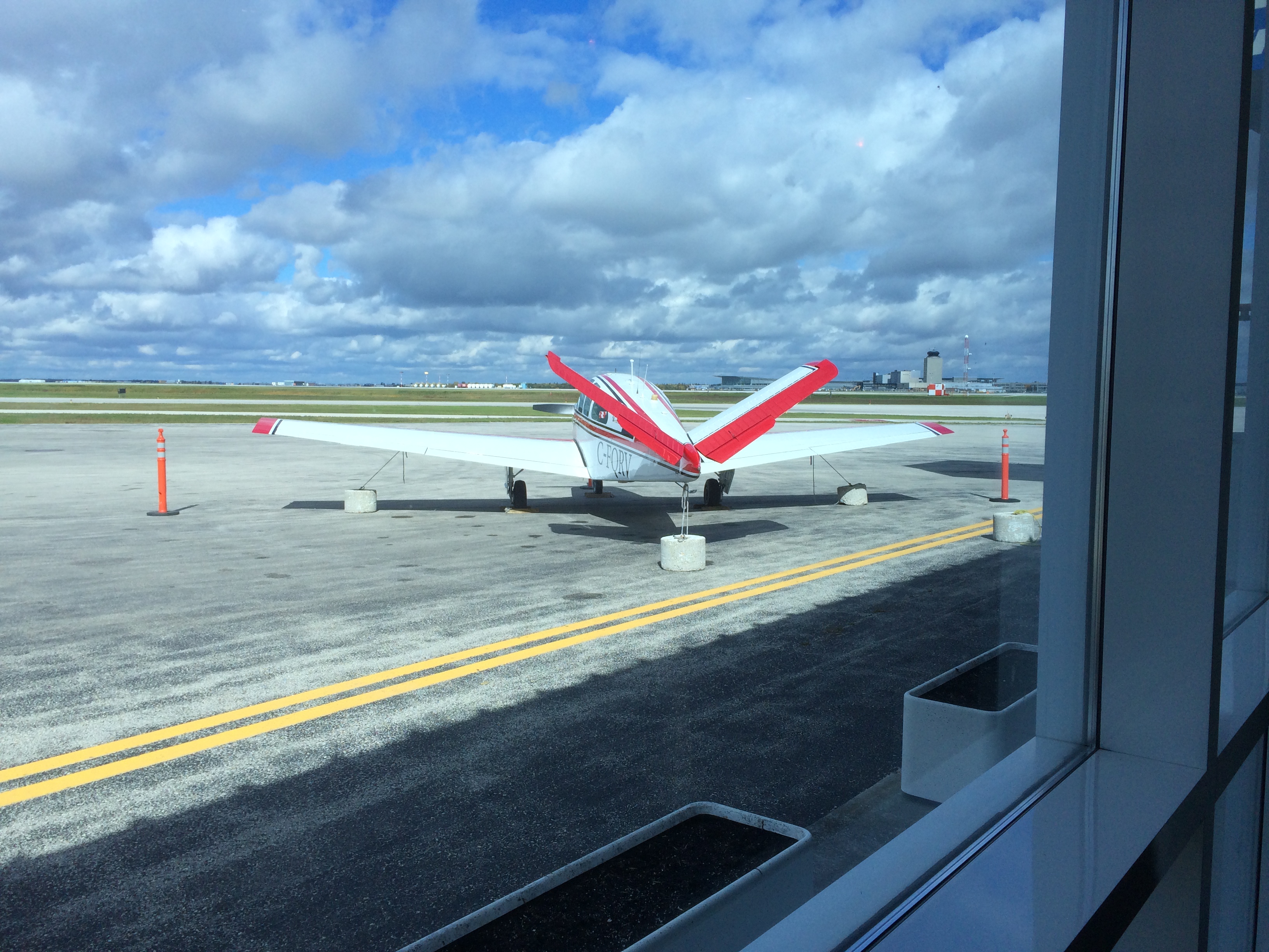 Here I am tied down at Avitat in Winnipeg. I'll get back to you about how to change the approach in the GTN 650 once it's activated.