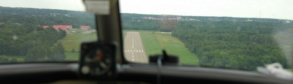
June 4, 2014 – Beautiful day
I awake to a perfect June morning. Clear skies, brisk southwest wind and air that seems to have come from Elysium. Surely it is the perfect day for flying.
Let's start where we did yesterday, to see what has changed. OK, I did take a peek before I went to bed last night at the Mixed Surface Analysis. (Just keeping track, comparing it to yesterday's forecasts.) Here are two MSA's in succession: yesterday evening and early this morning. Remember that pesky low out in the Atlantic? It's still there, and between these MSA's it hardly moves; it just drifts north a bit. And the other low – the one that was giving us the weather yesterday – it's still there, too, blocked from moving east by the pesky low. It, too, has just drifted north.

Mixed Surface Analysis 2100Z June 3

Mixed Surface Analysis 0900Z June 4
But look at the two cold fronts. Last evening the first one (the one that brought us the thunderstorms yesterday afternoon) was dissipating, although it was still dumping rain on New England. The second cold front was moving through Toronto, but generating a lot less weather than the first. This morning (the June 4 0900Z chart) that second front is drifting peaceably through Montreal and catching up with the remains of the first.
What does that mean for today?
Let's check out the Jetstream.
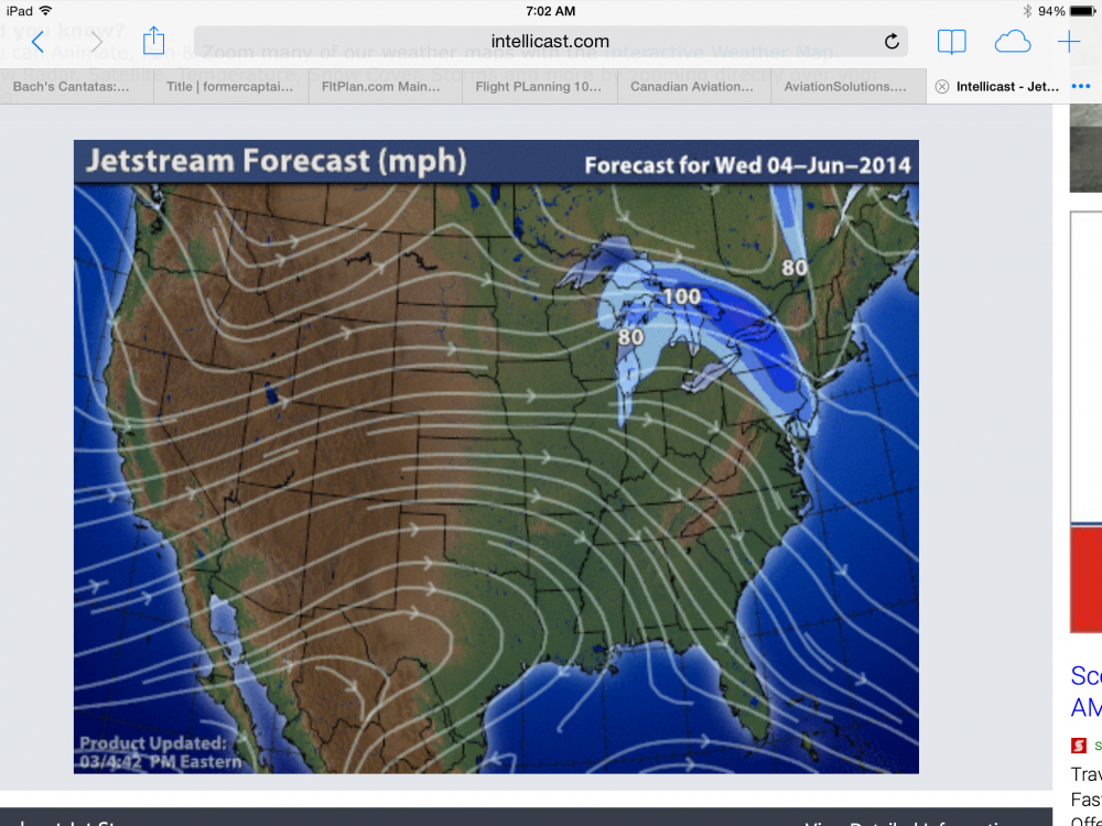
Jetstream
Again today the Jet is in summer mode: mild and drifting west to east with few kinks or swirls. But remember yesterday's kink where the wind changed direction by 180° over New England? It's still there, but it has straightened out: the plume from the northwest at 100 knots backs to 80 knots from the south. Over Montreal it is dragging the weather (the low) straight north even though we have a brisk southwester on the ground. Does that make sense?
Let's look at the 12-hour forecast (sometimes called a surface prog.).
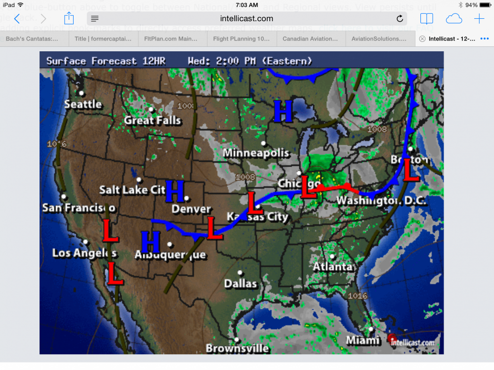
12-Hour Forecast
Our route sits just above the numbers 1008 (pressure in millibars) in the chart. There is a high to the northwest and the cold front is well east but there are showers shown where we want to go. The good news is that showers don't necessarily cramp our style and – we have to remember – showers on a prog. chart are not real. That's not radar imagery because it hasn't happened yet.
So we'll dig down a bit. Remember – here in Canada we have the GFA, the Graphical Area Forecast. (As an aside, remember too that a picture is worth a thousand words. We'll see the dark side of that when we get to NOTAMS.) I'm going to string three GFA's here one after the other, so you can see the movement. In the 0600Z the thunderstorm symbol is still there and our route is in the bottom of the green-hatched area. The low is moving NNE at 30 knots.
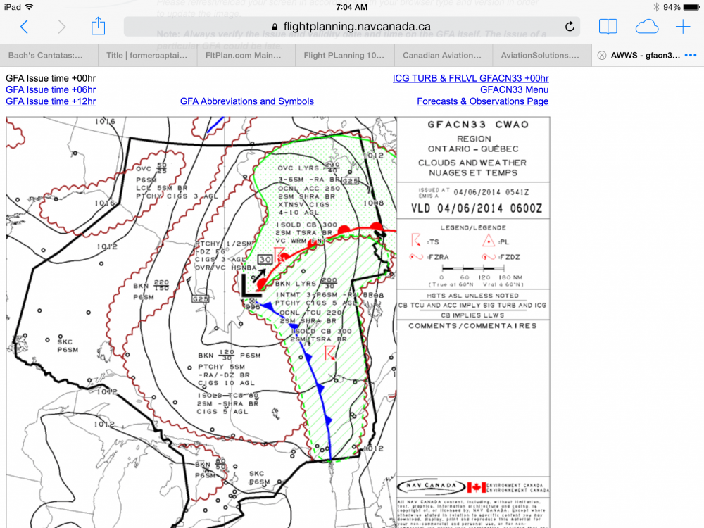
CLDS & WX 0600Z
At 1200Z our route is clear of the hatching. The forecast is for scattered cloud at 3000 feet with tops at 8000 feet. Visibilities will be better than 6 statute miles.

CLDS & WX 1200Z
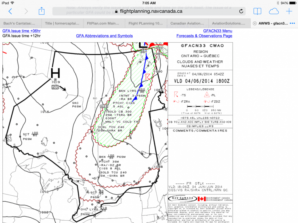
CLDS & WX 1800Z
At 1800Z (2PM and perhaps the end of the flight if I am a slow getting underway) that scattered cloud will become a broken layer with tops to 10,000 feet. Visibility will still be good underneath.
None of that sounds like a deal-breaker. But to be sure we should look at the Icing, Turbulence, and Freezing Level Charts. I know it's June, but you never know . . .
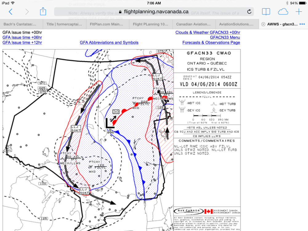
ICG TURB & FZLVL 0600Z
ICG TURB & FZLVL 1200Z

ICG TURB & FZLVL 1800Z
At 0600Z our freezing level is 12,000 feet, so that's not a problem. But look at that low-level jet: 60 knots from the south, on the east side of the low (still shown moving NNE at 30 knots), and curving down from the north at 50 knots on the west side. There are two things to notice here:
The low is moving NNE, but the low level winds are swirling around it. (Why is the low moving NNE? Remember the Jetstream? And why are the winds swirling counter-clockwise around the low? Hint: this is the northern hemisphere)
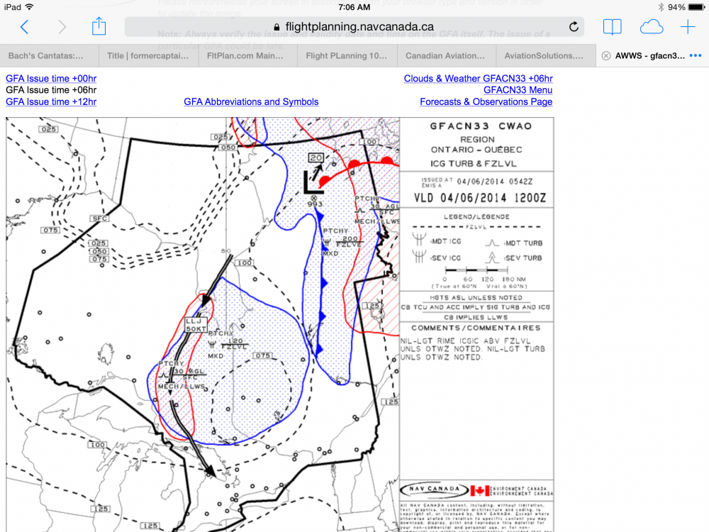
The air smelled ambrosial this morning, as if our planet were not yet civilized. Why? I think we were smelling James Bay air which had travelled over Algonquin Park. Odd, because the surface wind was from the southwest this morning. Look at the charts again (the ICG TURB & FZLVL) and see if it doesn't make more sense now.
Finally, to Flight Planning?
I am getting close to deciding it's a go today. But there's more work to do. I have to chose a route, prepare a flight log and the iPad, and file a flight plan.
Easy, right? GPS direct. After all, it's only 60 miles. You can practically see Ottawa from here.
Wait. Not so fast. First we have to consult the Canada Flight Supplement (CFS). Preferred IFR routes start on page C-100. On page C-107 we find Montreal Terminal Control Area (TCA) departures, and as we go down the list, on page C-108 we find: to CYOW (Ottawa, our destination) – via KESKA, ALSET, RIVER Arrival. Here it is:
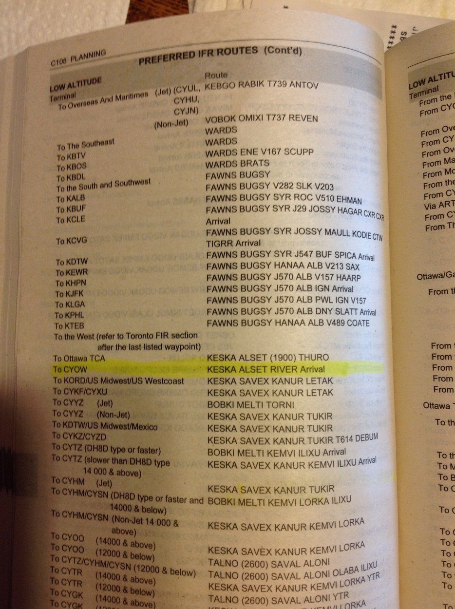
Canada Flight Supplement, Page C108
Let's try it. It's easy with ForeFlight on the iPad.
 Whoops. Not from Lachute. First, we'd have to backtrack, which is annoying. But that's not all. We would blast right through CYA 524, which tops out at 7000 feet. That's illegal. You can see it more clearly looking at the RIVER 9 Arrival: between ALSET and THURO we bisect CYA 524. Obviously this is for higher altitude arrivals.
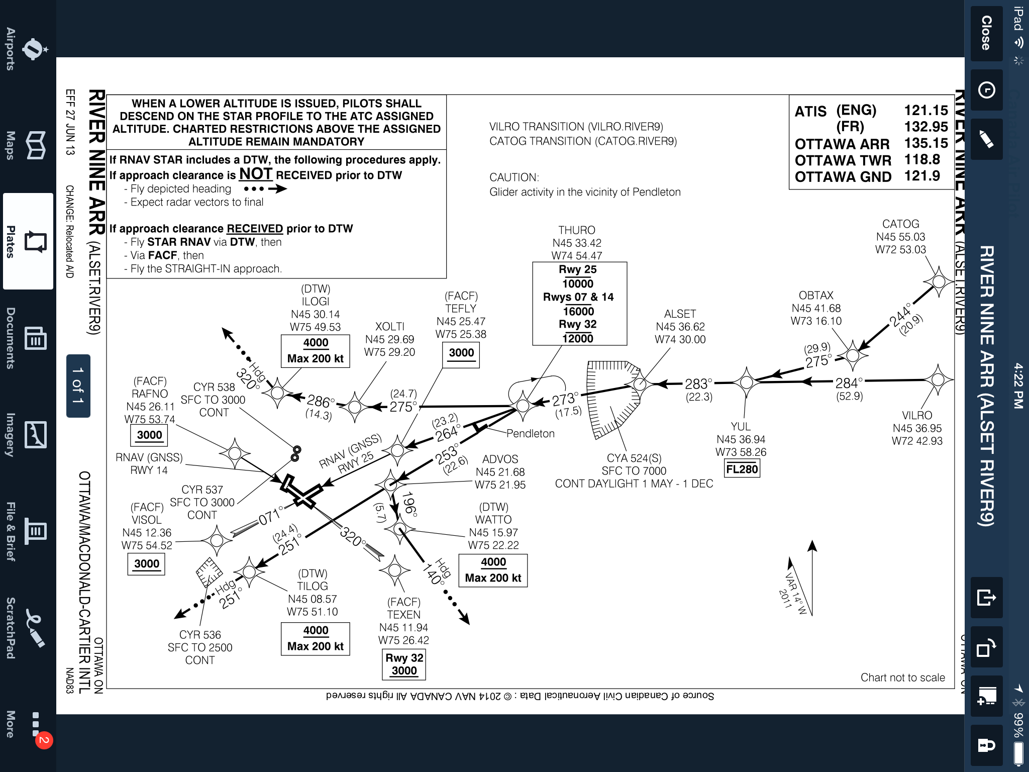
River Nine Arrival CYOW
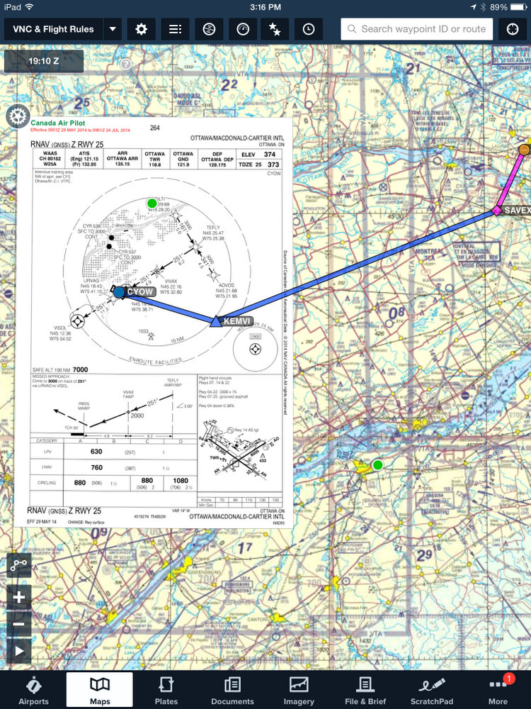
With today's light southwest breeze we will want to get to TEFLY (the Final Approach Course Fix , or FACF) for the GPS Z 25 approach, or perhaps to get cleared to the circuit for runway 22 (right traffic – the CFS again). Of course if the winds were light enough they might clear us to TEXEN, the FACF for runway 32. That way they would keep us (slow) out of the way of the turbines landing on runway 25.
I am trying to visualize all this as I flight plan, because being prepared is half the battle. I don't like being taken totally by surprise, and having to set up something new at the last minute. The good news is that in bad weather the air traffic controllers understand and work with you to keep your workload down. The flip side is that in good weather you should be prepared to help them move traffic. Hence “Can you accept a visual to runway 22?” That's probable today.
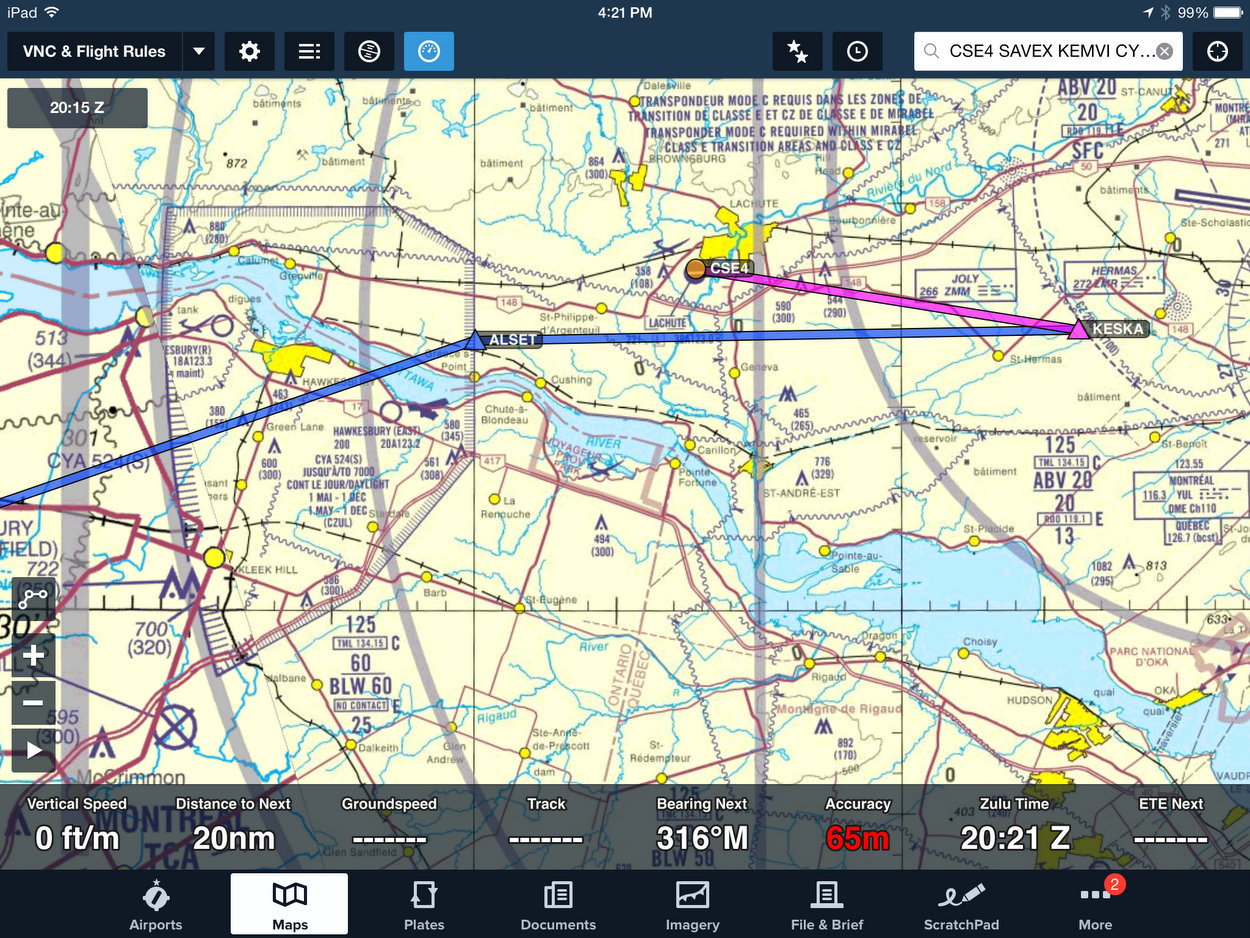
So here is the route I'm going to file:

Going via SAVEX I clear the corner of CYA524. Direct KEMVI keeps me clear and keeps me off the center lines of runways 25 and 32, and where all options are doable both for me and for the controller. At least that's the theory.
Now to NOTAMS. This is where some smart person could help by making all this information more readable. Something that could be scanned efficiently, combining pictures and symbols with words. Oh, well. At least we have a button for NOTAMS on AWWS, the top button above Graphic FA .
I request NOTAMS for Montreal (CYUL), Mirabel (CYMX), Gatineau (CYND), Ottawa CYOW), and Kingston (CYGK). Kingston has an ILS (limits 250/1) and is to the west, away from the low. We'll file it as an alternate, via Smiths Falls (CYSH). I won't bore you with reading the pages and pages that come up, but we do have to read them. Here is part of the information dealing with our destination, CYOW:
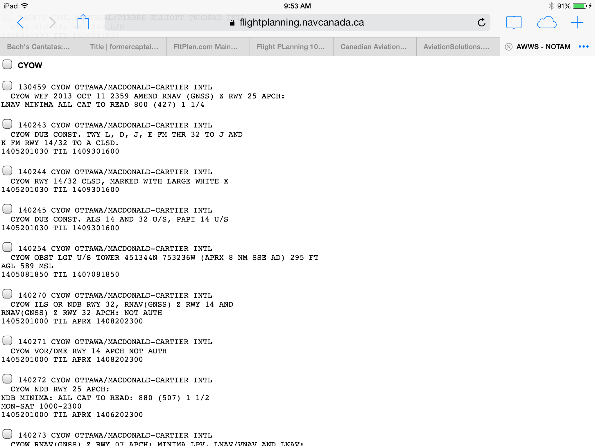
First Portion of NOTAMS for CYOW
Right off the top there is a minimums amendment to the approach we are expecting: the GPS Z 25. (RNAV (GNSS) Z RWY 25). The LNAV minimum is raised from 760 to 800 feet. That won't affect us, because we have a WAAS GPS which can do LPV approaches. So our minimum is still 630 MSL.
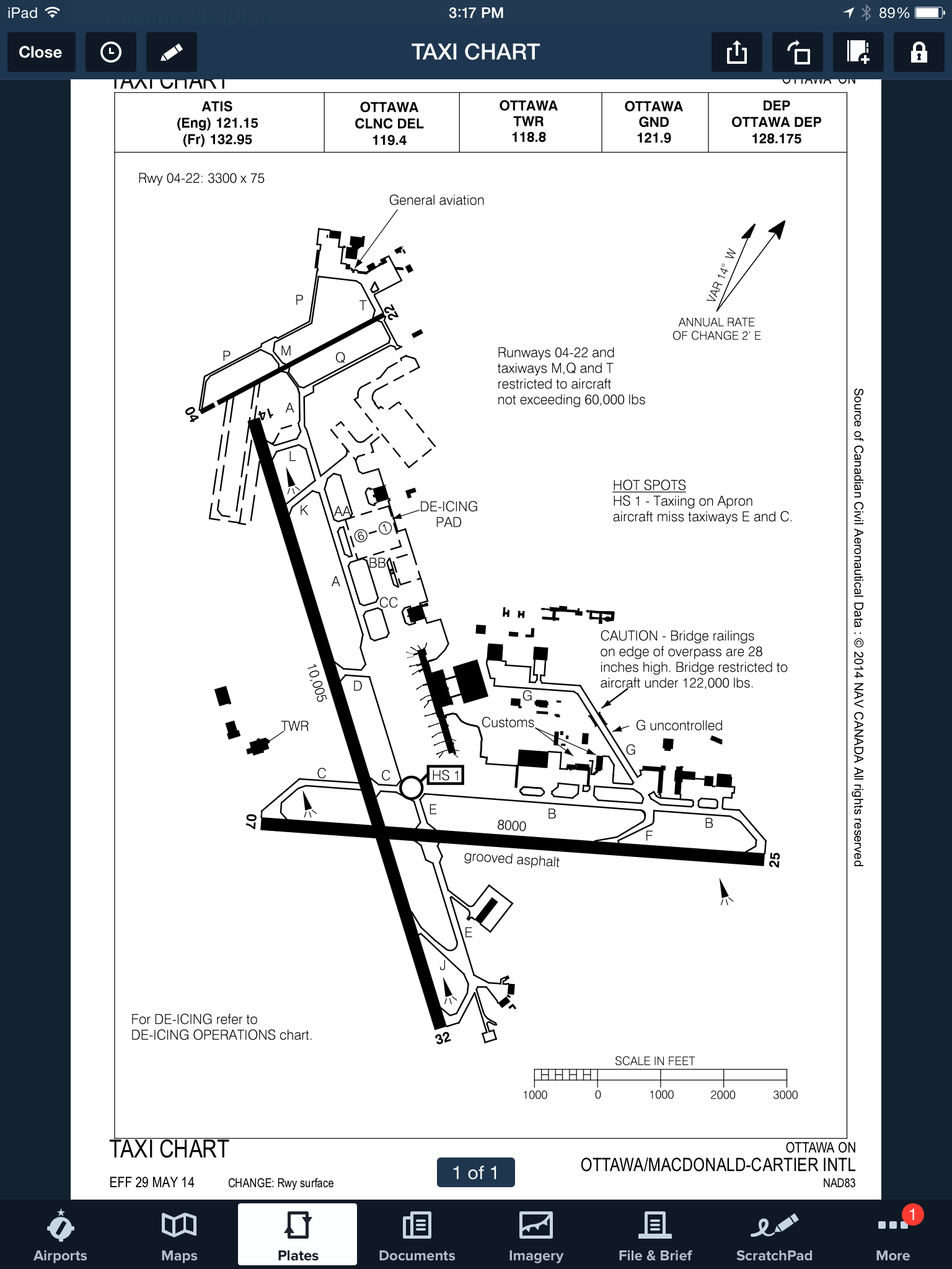
Continuing down the NOTAMS page, virtually every item concerns us. Runway 14/32 is closed until September 30th. Most of the taxiways that feed 14/32 are closed until the same date. Clearly there is major construction going on. We would look and feel really stupid if we arrived not knowing about all this.
 So grit your teeth and keep reading the NOTAMS.